On the night of October 10, 2024, darkness swept across Florida’s Gulf Coast as Hurricane Milton made landfall near Siesta Key in Sarasota County. The powerful Category 3 storm roared ashore at around 8:30 p.m., bringing with it devastating winds, deadly tornadoes, and relentless flooding that wreaked havoc on the region. With wind speeds exceeding 120 mph, Hurricane Milton left behind a trail of destruction, knocking out power for over 1.1 million homes and businesses, primarily in Sarasota, Manatee, and Hardee counties.

The Florida Division of Emergency Management (FDEM) issued urgent warnings through social media, advising residents to “shelter in place and remain vigilant” as the storm continued to bear down on the Gulf Coast. As Hurricane Milton approached, its impact became even more severe, with multiple tornadoes ripping through St. Lucie County, causing extensive damage and fatalities. Sheriff Keith Pearson confirmed that there were “multiple fatalities” at the Spanish Lakes Country Club, a senior community near Fort Pierce.
The exact number of deaths remains unknown as search and rescue operations continue in the aftermath of the storm. Sheriff Pearson stated that rescue teams are “listening for life” as they work tirelessly to find survivors amidst the devastation. Emergency responders are working around the clock, combing through wreckage in search of those trapped and providing aid to those affected. According to FDEM Director Kevin Guthrie, approximately 125 homes were confirmed destroyed across the state, with senior mobile home communities suffering the most damage.
Governor Ron DeSantis highlighted the widespread impact of Hurricane Milton, noting that the storm triggered a staggering 116 tornado warnings across Florida, with 19 confirmed tornado touchdowns. The destructive force of the tornadoes compounded the already severe damage caused by the hurricane, further disrupting lives and damaging property.
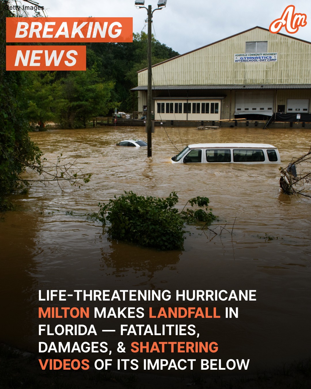
In addition to the tornadoes, St. Petersburg faced catastrophic flooding. More than nine inches of rain fell in just three hours, an event so rare that it is considered a one-in-1,000-year occurrence. The National Hurricane Center issued a flash flood emergency on October 9, covering St. Petersburg, Tampa, and Clearwater. The intense rain caused life-threatening flooding throughout the region, submerging roads and trapping residents in their homes.
St. Petersburg’s Albert Whitted Airport recorded an astonishing 16.61 inches of rain on October 9 alone. Wind gusts reached 102 mph at Sarasota-Bradenton International Airport, while Egmont Channel recorded gusts up to 105 mph. At the time, Hurricane Milton was located 20 miles northeast of Sarasota, moving east-northeast at a speed of 16 mph.
Given the extreme rainfall and severe conditions, the National Weather Service warned residents of the imminent risk of life-threatening flash floods. The advisory emphasized that the amount of rain typically seen over three months fell in a single day. Emergency alerts urged residents to seek higher ground and avoid flood-prone areas, while local authorities implemented widespread evacuation orders in the most at-risk zones.
In response to the disaster, state and local authorities quickly mobilized rescue teams and task forces to assist those affected by the hurricane. Sheriff Pearson stressed that “life safety” remains the top priority, as rescue workers continue to search for anyone who may be trapped under debris. The comprehensive emergency response aims to provide immediate relief while ensuring the safety of residents throughout the state.
Although Hurricane Milton has weakened slightly as it moves further inland, it continues to pose significant dangers. Authorities have urged residents to stay informed, follow official guidance, and take all necessary precautions as Florida braces for the storm’s lingering effects. The damage caused by Hurricane Milton is extensive, and the recovery process will undoubtedly be long and challenging for the communities affected.